Home to thousands of types of plants and birds, the Indian River Lagoon and Charlotte Harbor areas open a world of natural wonders.
The park ranger said it wouldn't take long to find the Shipyard Island campsite hidden away in the headwaters of the Mosquito Lagoon.
This pristine estuary in Florida, located just a few miles north of the Kennedy Space Center on the Canaveral National Seashore, lies between the heavily traveled Intracoastal Waterway to the west and the densely populated barrier islands of New Smyrna Beach to the east.
Now, however, less than a mile as the hawk flies from the boat ramp where I had launched my kayak, I was hopelessly lost.
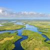
Out here paddling in the middle of the lagoon, where freshwater and saltwater blend together to provide a nursery for hundreds of marine species, the shoreline looks like an impenetrable wall of green.
As I study a map, drifting aimlessly through the islands of Spartina grass, I suddenly realize why Florida estuaries are called "the cradles of the ocean." These unique bodies of water, of which Florida has more than any other state, provide a home for more than 95 percent of the state's recreational and commercial species of fish, as well as countless birds and other marine life forms.
The point is hammered home when an osprey swoops low over the water and spooks a spotted sea trout in the shallows. As the fish swims to escape, the swirl of its tail shoots a few drops of water on my well-worn map.
Perhaps it isn't all that bad being lost, I think to myself. So I lie back, let the sun warm my face and listen to the gawk of a blue heron as it wades through the grass flats looking for finger mullet.
For a few minutes, I linger in a dream state, not quite asleep but so relaxed that I feel a little guilty. Out among the mangrove islands there are no cell phones, no deadlines, no worries other than finding a patch of dry land to pitch my tent.
The distant roar of a motorcycle barreling down A1A brings me back to my senses. I stop, think about where I am and remember the ranger's advice: Follow the shoreline.
This maritime wilderness is typical of all estuaries in Florida. Although they may go by different names - sounds, inlets, bays, harbors, lagoons - estuaries all share the same characteristic: a tidal zone where freshwater flowing from rivers and streams meets the saltwater of the open sea. The animals that live here must be adaptable and able to tolerate extreme heat and cold as well as floods, which bring more freshwater, and droughts, which bring an increase in salinity.
Activities in Indian River Lagoon
The Indian River Lagoon, which runs from Ponce De Leon Inlet at New Smyrna Beach south 156 miles to Jupiter Inlet, is unique among North American estuaries because it straddles the temperate and subtropical zones. A botanist's dream, the lagoon (which includes the Mosquito Lagoon and Banana River) provides a home to more than 2,100 different types of plants.
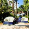
But as I work my way through the salt marsh, I am searching for one species of flora - oak. This tree grows only on high, dry ground and that is where I want to pitch my tent, far from the reach of the rising tide.
When exploring the Mosquito and Indian River Lagoons, you may notice the occasional small, low-rising hill, similar to the Turtle Mound near the entrance to the National Seashore. These earthen structures are man-made and all that is left of the Timucuan, the indigenous people who made their home here for more than 2,000 years. These middens, piles of oyster shells from ancient feasts, have great historic value and should not be disturbed.
I'm startled from my historical reverie by some movement in the grass. Could I be lucky enough to catch a glimpse of the threatened Atlantic salt marsh snake? This reptile, like the 65 other species of protected animals that make their home within the lagoon watershed, is rarely seen by visitors. Pressing on, I land my canoe just before dark and notice the tiny paw prints of one of the lagoon's more common residents, the raccoon.
It has taken just a few hours of leisurely paddling the Indian River Lagoon to reach this campsite with a million-dollar view. Looking west toward the setting sun, I can't remember the last time I had such a wonderful campsite all to myself. It was probably when I crossed the Everglades by canoe. But that journey trip took a week. This trip took just a few hours.
One could keep paddling south all the way to Jupiter Inlet. There are good campsites and even better fishing. A trip like that would take weeks. But what better way to spend my vacation? So I pull out my map and start planning my route.
Paddling Charlotte Harbor
Unlike other estuaries in Florida that are mostly influenced by the sea, Charlotte Harbor has more of the trademarks of a freshwater system, thanks to the Peace River.
While the Peace isn't the only river that flows into the Charlotte estuary, it is the largest. The 2,300-mile watershed drains some of Florida's largest tracts of unspoiled wilderness, so the greatest challenge for explorers is limiting the scope of the adventure.
Charlotte Harbor, unlike urbanized Tampa Bay, has maintained most of its natural systems. The many barrier islands that protect the harbor and its seagrass beds from the open sea also provide some of the best opportunities for exploration.
Just 17 miles long, Charlotte County has more than 120 miles of tidal coastline, the vast majority within the confines of Charlotte Harbor, one of Florida's premier fishing and birding spots. An often-overlooked destination, Charlotte County is rich in history. Ponce de Leon and Hernando de Soto both made landfall here, and the name itself comes from King George III's wife, Charlotte Sofia.
Most of Little Gasparilla Island, the crown jewel of a barrier chain that guards the entrance to Charlotte Harbor, is privately owned. The exception is a 1.3-mile tract of land in Don Pedro Island State Park at the island's southern end.
Purchased by the State of Florida in 1984 for $6 million under the Save Our Coasts program, Don Pedro is only accessible by canoe, kayak or private boat. The park has 12 public boat slips. You can launch from the county ramp or at Eldred's Marina in Placida for $5.35. It will take about an hour to paddle there from Eldred's. The state park charges a day use fee, but it is the best $1 you will ever spend.
On the Charlotte County, or northern, side of the harbor, both Gasparilla Sound and Island Bay offer good, sheltered, shallow-water paddling. One favorite destination is Boggess Hole, a small bay hidden away in the mangroves, which can be accessed via Placida.
This Florida estuary has its share of shell mounds, built by the Calusa; they rise anywhere from 10 to 20 feet above the surrounding mangroves. An industrious people, the Calusa built stilt homes and temples on top of the flat-top mounds throughout the Charlotte Harbor area. Paddling through the mangroves, one can't help but wonder if these same waters were once crowded with canoes as the Calusa scoured the bay in search of fish, oysters and game.
The Cape Haze area has another treasure: birds. The nearby Island Bay National Wildlife Refuge, a 20-acre tract encompassing six small islands, is a breeding ground for a variety of heron and egret species. To visit this birder's paradise, put in at Placida. But remember that these islands and their inhabitants are protected.
If you are looking for an overnight adventure, Lee County's Pine Island serves as the best starting point for a trip to Cabbage Key or Cayo Costa State Park.
Cabbage Key Inn offers lodging and good food, including an excellent cheeseburger said to have inspired singer Jimmy Buffet to pen his tribute to an American staple.
