Florida's hiking trails offer wildlife viewing, botanical diversity, and levels of difficulty from beginner to one of the toughest trails in America.
By Sandra Friend
On my last backpacking trip, my socks melted. Honest.
It wasn't the trail's fault. Not directly. I was out with seven friends, surveying a brand-new 72-mile footpath under construction. And this was the day we hit The Wall - a natural barrier of cypress strands across Palm Beach County. Chilly, wet and exhausted from pushing a measuring wheel all day, I flopped into my tent that night and came up with a plan.
Take a palmetto stem. Add a sock. Dangle over flames. Watching, my buddies followed suit. Steam rose. And then I checked my new Ultimax socks and discovered they were crispy. Made from petroleum by-products. I held them up for inspection.
"Ah, guys... if your socks aren't cotton, you'd better get them away from the fire. Now."
Where else in the continental United States can you shoulder your pack and hit the trail in the dead of winter with little concern for ice or snow? On the Florida Trail, one of only 11 National Scenic Trails in the United States, you can leave those worries at home while soaking up the welcoming warmth of the South. In its 1,400-mile journey from the Big Cypress National Preserve in South Florida to Fort Pickens on Pensacola Beach in northwest Florida, our state's premier hiking trail offers prime destinations for backpackers of all experience levels.
It started with a dream. In 1964, Miami resident Jim Kern returned from an Appalachian Trail backpacking trip with a burning desire for a long hike in his own backyard. Kern envisioned "at least 500 miles" of hiking, and founded the Florida Trail Association (FTA) to bring together like-minded volunteers to carry forth his plan.
Even 45 years after it began, the Florida Trail remains a work in progress. The intent is a protected wilderness corridor the length of Florida to protect "Florida's Footpath Forever." The reality is a thousand miles of completed trail tied together with orange blazes following back roads until the remainder of the 1,400-mile corridor can be acquired and protected.
OCALA SECTION (North and South)
A handful of hardy backpackers take on the entire trail each year, but most are out for a week or a weekend. New to Florida hiking? Start your exploration on the Ocala Section, where the Florida Trail's first blaze was painted in the Ocala National Forest in 1966.
Described as the "jewel of the Trail," this well-worn 70-plus-mile footpath meanders around picture-perfect ponds and prairies, vanishes into hammocks of moss-draped oaks, and rises over the brilliant white quartz dunes of the Big Scrub. White-tailed deer browse in the haze of wiregrass beneath longleaf pines, while Florida scrub-jays flit between the sand pines. In the Juniper Prairie Wilderness, shed your pack at Hidden Pond and take a swim, and then set up camp beneath the canopy of oaks to watch sunset on the prairie. Gentle to moderate and with plenty of well-marked trailheads, the Ocala section is ideal for beginning backpackers and families.
SUWANNEE SECTION
Okay, you say, you want a challenge - serious climbs on rugged terrain. Look no farther than the Suwannee Section between Big Shoals, Florida's only Class III whitewater, and Mill Creek near Dowling Park. This 41.6-mile traverse has you clambering in and out of gullies, walking scenic but oh-so-slender sand levees, and hopping over the tumbling froth of the Suwannee River's many tributaries.
Waterfalls and whirlpools, deep sinkholes and bubbling springs are all part of a hike where Florida's unique geological features are right there on the surface. Camp on sandy beaches or on high bluffs shaded by spreading live oaks and massive tupelo trees. Moderate to strenuous, this section remains dry at the whim of the river; flood stage (over 60 feet) swamps the footpath. In order to hike the entire riverside segment, you must be an FTA member, as the trail passes through some private backyards downstream from White Springs. (For this reason, always remember to carry your FTA membership card with you).
EGLIN SECTION (East, North and West)
Rhododendron-lined creeks and fragrant titi swamps punctuate the rolling clay hills of the Eglin Section, where you climb up and down natural drainages, crossing dozens of watercourses on sturdy log bridges. Designated the Choctawhatchee National Forest in 1908, this 724-square-mile preserve protected one of the nation's largest stands of old growth longleaf pine, and with it, colonies of red-cockaded woodpeckers. The land changed hands in 1940, becoming Eglin Air Force Base.
The trail follows the northern and western borders of the base; numerous designated campsites have picnic tables, benches, fire rings and easy access to water. It's a pleasant, moderate hike that keeps you immersed in the forest for days on end. An inexpensive Eglin Recreational Permit is required to hike this section.
OKEECHOBEE SECTION (East, North, South, West)
On the Okeechobee Section, enjoy a nine-day walk around the second largest freshwater lake in the United States - Lake Okeechobee. Atop the Herbert Hoover Dike, the trail affords the most expansive scenic view in the state. On a clear day in Okeechobee you can see puffs of steam from the refinery in Clewiston, more than 50 miles away. Maintained by the U.S. Army Corps of Engineers, the dike was built in response to a 1926 tragedy; thousands died when a hurricane pushed the lake out of its basin and into the towns of Pahokee, Belle Glade and South Bay.
While the recent paving of portions of the dike has changed the character of the hike, it's still possible to amble along the water's edge and kick back at sheltered benches overlooking palmetto-dotted prairies. You'll spy everything from caracara to white pelicans, so bring your binoculars! Designated campsites on this 127-mile loop (East – 22.3 miles; North- 33.1 miles; West-40.5 miles; South-31.3 miles) have picnic tables and fire rings, and the trail passes by numerous towns. Easy to moderate, the main challenge for this section is the lack of shade and the hard-packed footpath or pavement, all of which is tough on the feet.
ST. MARKS/AUCILLA & APALACHICOLA (East and West) SECTIONS
From the Ring Levee you can see the entire sweep of Florida's Big Bend, the Gulf of Mexico a vast shimmering sheet to the south. Is this your highlight for your hike through the Big Bend Section, or is it the cool pool of robin's-egg-blue called Shepherd Spring, hidden in the glorious Cathedral of ancient sabal palms? The 52.5-mile traverse of St. Marks National Wildlife Refuge leads you through pine flatwoods and salt marshes, across impoundments where alligators laze and to the St. Marks River, where backpackers must hail a boat to cross. Hiking is gentle to moderate, but can be tricky when the tide comes in high and shifts the boardwalks. Bear sightings are common.
Since this is the only national wildlife refuge in the United States where primitive camping is permitted, you must commit to completing the entire hike across the refuge on your outing. The adjacent 83.7-mile moderate-to-strenuous Apalachicola Section (East-48.8 miles; West-34.9 miles) offers scenic rivers, miles of pine flatwoods, steephead ravines, delicate pitcher plant prairies and Bradwell Bay, a seven-mile swamp walk ranked by Backpacker magazine as one of the toughest trails in America.
BIG CYPRESS SECTION (North and South)
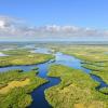
Finally, take on a challenge that only Florida can deliver - wade through the habitat of the Florida panther in the Big Cypress Section, where for more than 54.8 miles (North-30.2 miles; South-24.6 miles), you marvel at the primitive beauty of this grand watery wilderness. Summer rains form a sheet flow that trickle through a million acres of sawgrass prairies and cypress strands en route to the Everglades. Giant fern forests spring from jagged limestone, and ghostly stands of dwarf cypress rise from open plains. In the jungle-like cypress strands, look up and see a tropical wonderland of delicate clamshell and greenfly orchids and giant bromeliads. A truly strenuous outing, where a mile-an-hour pace is good, this is a trip best completed with a companion.
IT'S NOT A WALK IN THE PARK
If you're from a mountainous state, don't assume "flat" Florida hiking is boring. Florida ranks third in the nation for botanical diversity, with more than 80 distinct plant communities. Just a few inches of elevation change affects the surrounding mix of habitats, so the sheer variety of what you see on a day's hike can be downright impressive.
So, you've challenged the Appalachians and braved the Rockies, and now you're in Florida, eager for more backpacking. Before you pooh-pooh our lack of mountains, count on this: it won't be a walk in the park. The ground beneath your feet can vary from rugged limestone outcroppings to slippery clay, hard-packed fossilized shells, sticky marl mud, soft sugar sand or rotting leaves beneath knee-deep water. Use a hiking stick for balance, wear comfortable shoes appropriate to the terrain, and take along a dose of common sense. Know the habitats you'll encounter.
Hiking through a swamp? Don't take your dog - but do consider a camping hammock. Headed into the scrub? Haul plenty of water. Walking the dikes? Use serious sun protection. Respect the landscape, and you'll enjoy your journey. And follow the usual precautions - leave your itinerary with friends or family, and carry a map and a compass or GPS.
WHEN YOU GO...
Check out the Florida National Scenic Trail by region and plan your trip: floridatrail.org/the-florida-trail-by-region/
#LOVEFL + #HIKING
Follow your sunshine in Florida and share it with the world.


