





GULF ISLANDS NATIONAL SEASHORE
Where
Stretched across miles of Mississippi and Florida, Gulf Islands National Seashore promises emerald shores, stunning white beaches, lush marshlands, and rich historical landscapes. Florida locations include the Okaloosa, Perdido Key, and Santa Rosa areas—and more. Amid this treasure trove of sugar sand, Langdon Beach in the Fort Pickens area is a favorite. The entryway to Fort Pickens is located at 1400 Fort Pickens Rd, Gulf Breeze, FL 32561. 4.4 miles past it on the left (south side), you’ll find Langdon, which doesn’t have an address. Here’s a Fort Pickens Area Map. You can also access Langdon via a free tram, which operates on Fridays and Saturdays.
Vibe
Stunning, natural sugar-sand beach with amenities like restrooms and showers.
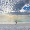
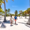
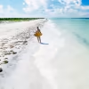
Popular but not overcrowded, Langdon is sited on a pristine, undeveloped shoreline. It has a relaxed personality, with families body-surfing the waves; pelicans diving in search of meal; and luxe boats cruising offshore.
See, feel
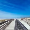
The drive into Langdon is a preview of what’s to come, with Fort Pickens Road carving through a sandy, white landscape that you’d swear was snow—if only you didn’t have the air conditioning on. The beach is heaped with the same white sand, bordered by exceptionally clear, emerald-tinted water, stretching as far as the eye can see in both directions. Rolling dunes and a natural landscape provide a glorious backdrop. Here, you’re likely to see beachgoers working on the perfect tan; kids digging in the sand; and epic sunsets.
The water’s usually relatively calm, but tides, winds, and offshore systems can sometimes cause rough conditions.
On or near the beach
Kick back; stroll the shoreline; swim; or bring a kayak or SUP for a paddle.
Beyond the beach, Fort Pickens invites you to discover Fort Pickens, Battery Cooper, and Battery Worth; pick up a souvenir at the store; or fish from the pier or the shores—but not in Langdon Beach. For an epic hike, explore the Florida National Scenic Trail, paralleling the Gulf of America. You can even spend the night on a camping expedition.
Accessibility
Langdon Beach offers accessible beach mats and beach wheelchairs. Ask a ranger in the campground registration office to borrow the beach wheelchair. The accessibility page sets out what's available area by area
Facilities
Amenities at Langdon Beach include free tram stop; a picnic shelter/pavilion; picnic table; restroom; showers; trash dumpster; water-bottle-filling station; and drinking water. Concessions are only provided in the ferry plaza mine storeroom building. Here’s a Fort Pickens Area Map that includes location amenities throughout the park. Bring chairs, umbrellas, coolers, and whatever else you need, because rentals aren’t available.
Lifeguards
Langdon Beach Swim Beach has a lifeguard assigned from Memorial Day to Labor Day.
Parking
Langdon Beach offers 40 parking spots. You can also access Langdon from other areas inside the park via a free tram, which operates on Fridays and Saturdays. Here’s a map with parking locations throughout the Fort Pickens area. Parking is included with park admission.
FREQUENTLY ASKED QUESTIONS ABOUT GULF ISLANDS NATIONAL SEASHORE
Q. What is Gulf Islands National Seashore?
A. A National Park Service unit protecting barrier islands, beaches, bayous and historic forts along the northern Gulf. It isn't one continuous place. The seashore is a string of separate areas spread across two states, Florida and Mississippi, with stretches of private and city land in between.
Park headquarters is at 1801 Gulf Breeze Parkway, Gulf Breeze, Florida 32563, and general questions go to 850-934-2600.
Q. Which areas are in Florida?
A. Six, and they're genuinely different from one another.
Fort Pickens, on the western tip of Santa Rosa Island past Pensacola Beach, is the most visited part of the Florida district and holds the 19th-century masonry fort, the campground and Langdon Beach. The Santa Rosa Area, further east on the same island, is day use only and centers on Opal Beach, a long undeveloped stretch with picnic pavilions. The Perdido Key Area, usually called Johnson Beach, sits southwest of Pensacola. Naval Live Oaks in Gulf Breeze is the wooded mainland piece, with trails and the visitor center rather than a swimming beach. The Okaloosa Area, near Fort Walton Beach, is a small day-use spot on the sound. Located aboard Naval Air Station Pensacola, an active military base, Gulf Islands National Seashore’s Fort Barrancas Area features three historic fortifications, including the Spanish Water Battery, Fort Barrancas, and Advanced Redoubt.
The area also includes two short hiking trails, wayside exhibits, and a visitor center with restrooms, information, and park staff to help you enjoy your visit.
Q. What are the hours?
A. They vary by area. Naval Live Oaks is open 8 a.m. to sunset. In the Santa Rosa Area, the Opal Beach Complex is 8 a.m. to sunset, but Highway 399/J. Earle Bowden Way is open 24 hours a day year-round. Fort Pickens is open for self-guided tours 8 a.m. to sunset. The Okaloosa Area opens 8 a.m. to sunset.
The Perdido Key Area runs longer hours than the rest: 5 a.m. to 8 p.m. from March 1 through Oct. 31, and 5 a.m. to 6 p.m. from Nov. 1 through the end of February. Overnight parking is prohibited there.
Q. Is there an entrance fee?
A. Yes, for four areas: Fort Pickens, Opal Beach, Okaloosa and Perdido Key. It covers seven days. There are separate rates for a vehicle, a motorcycle, and anyone arriving on foot or by bicycle. Naval Live Oaks has no entrance fee.
Bring a card rather than cash. Current rates and the pass options, including the America the Beautiful annual pass, are on the park's fees page.
Q. Are there lifeguards?
A. Only at four beaches, and only in summer. From mid-May through August the Park Service may staffs lifeguards at Langdon Beach in the Fort Pickens Area, Opal Beach in the Santa Rosa Area, Johnson Beach in the Perdido Key Area, and the designated swim beach on the south shore of Ship Island over in Mississippi.
Everywhere else in the seashore, and everywhere outside the summer window, there are no lifeguards at all. Given how much of this park is undeveloped shoreline, that covers most of it. Confirm current dates with the park before you plan around them.
Q. How do I judge the water?
A. Beach condition flags are posted at the staffed areas and entrance stations. The Park Service is direct that this coast carries a high risk of rip currents, and that risk doesn't disappear when the surface looks calm.
Learn the colors: green for low hazard, yellow for moderate surf or currents, red for high surf or strong currents, double red meaning the water is closed, and purple for stinging marine life. Green means low hazard, not safe.
If a rip current takes you out, don't try to swim straight back to the beach. Swim parallel to shore until the pull releases you, then come in at an angle. Call 911 in an emergency. On the long undeveloped stretches, where you may be a mile or more from another person, the sensible rule is not to swim alone.
Q. Can I camp?
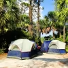
A. Yes, at Fort Pickens, which has the only developed campground on the Florida side. Sites come with and without electric, and each has a fire ring, picnic table and a paved pad. There are heated showers and flush toilets.
NPS also allows boat-in backcountry camping at the Perdido Key Area, beginning ½ mile east of the Johnson Beach turnaround and continuing toward Pensacola Pass. Walk-in and drop-off camping aren't allowed. The undeveloped Mississippi islands also allow boat-in camping. Book through recreation.gov, and book early, because winter here is a popular snowbird season and sites go months ahead. Mississippi's Davis Bayou has the other developed campground.
Q. Can I bring my dog?
A. Not onto the beaches. Pets are prohibited on all park beaches, Gulf and bay side, but are allowed on trails, multi-use paths and park roads on a leash no longer than six feet.
Service animals as defined by the Americans with Disabilities Act are permitted. Emotional support animals are not covered by that exemption. The full rules are on the park's pet page.
Q. Is the seashore accessible?
A. A beach wheelchair is available in the Perdido Key Area at Johnson Beach; ask a ranger or volunteer. The Perdido Key Discovery Trail is an accessible boardwalk loop through the dunes, and there are accessible restrooms at the developed areas.
Fort Pickens has accessible parking and restrooms, though the historic fort itself has uneven surfaces, steps and narrow passages that limit access in places. The accessibility page sets out what's available area by area, and it's worth reading before you choose which part of the park to visit.
Q. What are the rules on the beach?
A. Glass is prohibited throughout. Drones need written approval. Groups of 26 or more people need a permit.
Crossing the dunes is prohibited except at designated boardwalks and marked access points, and it's enforced rather than suggested. The dune plants hold the islands together and shelter protected species, including the endangered Perdido Key beach mouse at the western end.
Q. Why is the sand so white?
A. It's more than 99 percent clear quartz. The Park Service traces the grains back to the Appalachian Mountains, eroded over millions of years and carried to the coast by rivers, then pushed westward along the shore by longshore currents.
Quartz reflects heat rather than absorbing it, which is why this sand stays walkable barefoot in August when the parking lot doesn't.
Q. What is there to do besides swim?
A. Fort Pickens is the standout. The fort dates to the 1830s, and you can walk it on your own; it later held Apache prisoners including Geronimo. Batteries from later eras are scattered around the grounds.
Beyond that: fishing, paddling on the sound side, birding, and cycling the road out to Fort Pickens. Naval Live Oaks has shaded hiking trails and the park's visitor center, which is a good first stop and free to enter.
Q. When should I visit?
A. Late spring and early fall give you warm water without midsummer heat and crowds. Summer is hot and humid with afternoon thunderstorms that usually clear quickly, the warmest water of the year, and the only period with lifeguards. The Perdido Key Area fills to capacity and closes its gates on busy days from April through September, so arrive early.
Winter is quiet and mild on land, and good for walking, fort tours and camping. The Gulf drops into the low to mid-60s in January and February, though, which is too cold for most people to swim.
Areas and roads here do close from time to time for weather, repairs or wildlife protection, so check the park's alerts before driving out.
Q. What about sea turtles?
A. Nesting season along this coast runs May 1 through Oct. 31, with nesting peaking around July and hatchlings emerging through August and September. Loggerheads do most of it, with green, Kemp's ridley and leatherback turtles also recorded.
Take furniture, toys and canopies off the beach each night, fill in any holes you dig and flatten sandcastles, because all of it can trap a hatchling. Keep lights off the beach after dark. If you come across a nesting turtle, don't approach it, use a flash or shine a light on it; watch from a distance and tell a ranger. The park explains what helps on its sea turtle page, and stranded or injured wildlife in Florida goes to 888-404-3922.


